What is it?
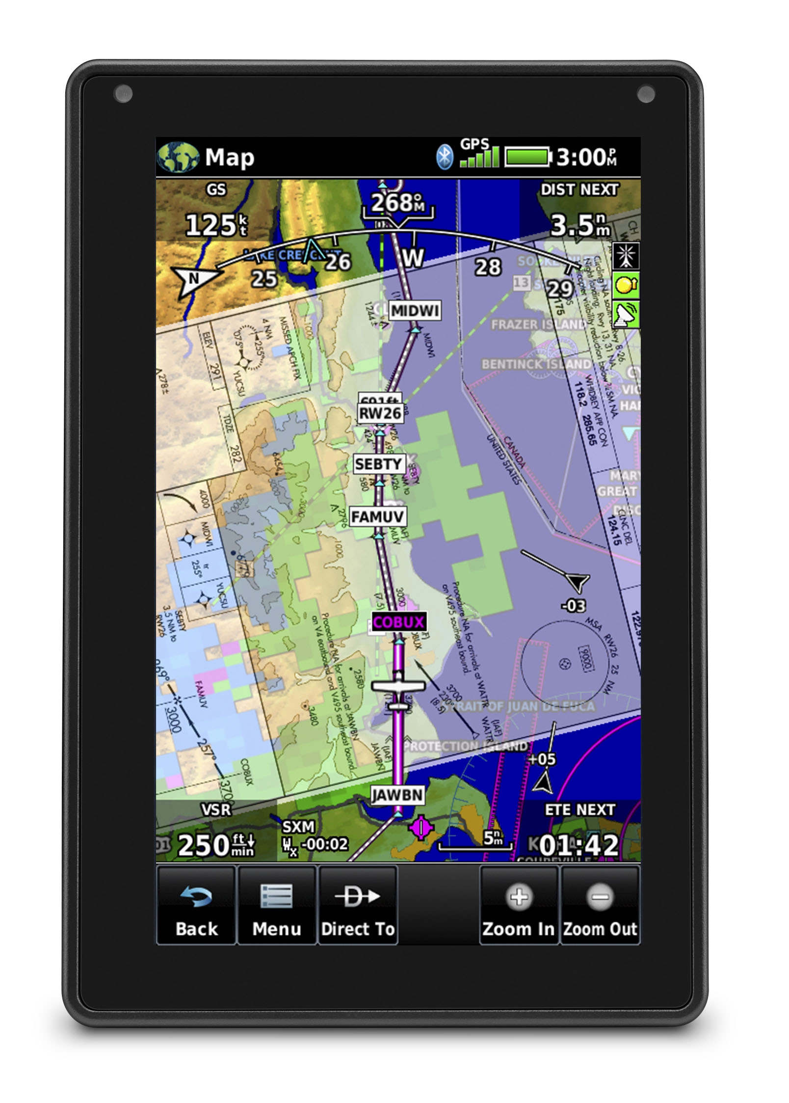 At first glance, the new aera 760 looks like a larger version of the venerable aera 660. That’s true to an extent—it shares many of the best features of its little brother, like a built-in battery and GPS antenna—but it also includes some significant upgrades, like full instrument approaches, a built-in AHRS, and a sunlight-readable 7” screen. It also has new pre-flight capabilities and robust avionics connectivity.
In the end, the aera 760 can really fulfill three roles: a pre-flight planning tool, a dedicated in-flight navigator for airplanes with limited panel avionics, or a rugged backup option in an emergency. This versatility is one of its main strengths.
Pre-flight tools
After using the aera 760 for a while, we think the biggest news might be its value outside the cockpit. If you’re thinking of an old GPS that can only do direct-to navigation, think again. This is a real EFB that can do most of the pre-flight jobs a tablet can. With built-in WiFi, it’s easy to connect to a home or FBO WiFi network and review prefight weather, from radar to METARs to AIRMETs. You can also download databases, and Garmin’s single annual subscription makes it easy to stay updated, just like you would with an iPad app.
We also used the 760 to find the perfect fuel stop by selecting the fuel price layer on the moving map, a feature you simply won’t find on older generation portables.You can also review the prices, along with detailed facility information, on the airport directory page. This makes it easy to pick the right airport and FBO.
The aera 760 is also a complete aviation reference. It includes georeferenced IFR and VFR charts, a PDF viewer, an interactive E6B computer, a weight and balance calculator, and even a digital logbook.
New in-flight features
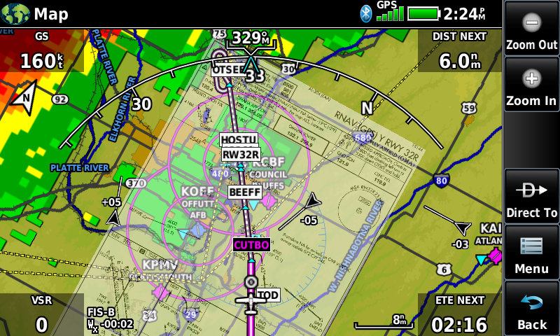 The first thing you’ll notice is that Garmin’s powerful flight plan and instrument procedure tools have come to a portable GPS with the aera 760. Enter a departure and destination airport, and then it’s easy to add IFR airways, instrument approaches, SIDs, or STARs. This is route planning pretty much just like you’d do on a GTN 750 panel-mount GPS. Of course, direct-to navigation is always one touch away for quick changes in flight, which is helpful in an emergency. Just remember that, like all portable devices, the 760 is not approved for primary IFR navigation.
Beyond the flight plan features, you’ll also find complete digital charts, meaning the 760 can be your primary reference—no need for paper charts or an iPad. This includes sectionals and IFR high/low enroute charts for the US, Canada, and Europe, plus Garmin’s exclusive SafeTaxi diagrams for hundreds of airports and instrument approach plates. We used these charts to plan trips and navigate in flight, and the large, bright screen makes it easy to read all the details. You can pinch to zoom and pan around to read all the details, and the touchscreen was very responsive in our testing.
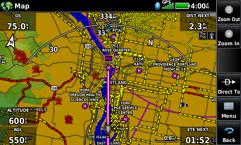 There's even a built-in AHRS to drive a backup attitude indicator and synthetic vision. Note that this is off by default, and should be turned on when the unit is mounted securely in the airplane (not on the yoke). Another helpful feature, especially for low level flyers, is Garmin’s WireAware. While terrain databases can warn of nearby mountains and towers, that isn’t always enough. For helicopter pilots in particular, the display of Hazardous Obstacle Transmission (HOT) lines on the map can be a real safety enhancement. Is there a wire across that valley? Now you’ll know.
There are a host of other little features we liked, like the ability to load street intersections using optional map databases, which should be a valuable tool for law enforcement pilots. And we’ve always appreciated Garmin’s Smart Airspace notifications, which only highlight nearby airspace that might impact your flight, minimizing any sectors that are above or below your altitude.
Avionics connectivity
Finally, as you might expect from Garmin, serious avionics connectivity is built-in, including weather, traffic, AHRS data, flight plans, and more.
The options for displaying weather are broad. You can bring in subscription-free ADS-B weather from a GDL 50 or 52 portable receiver or from a panel-mount like the GTX 345 transponder, all of which connect wirelessly via Bluetooth. Or show SiriusXM satellite weather by connecting to a portable GDL 52.
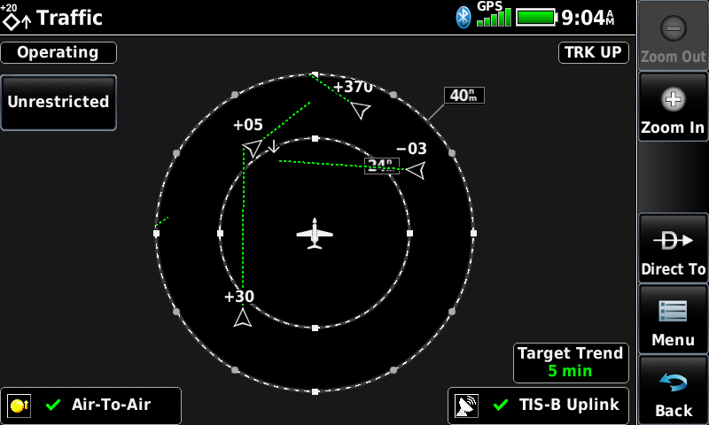 Garmin’s industry-leading traffic features are here as well, when connected to an ADS-B receiver. The aera 760 supports TargetTrend, which shows closure rates and relative trajectories, while TerminalTraffic offers traffic alerts even on the ground. This is a much more intuitive and actionable display of nearby traffic that just raw targets on a map.
Synthetic Vision is another powerful tool that can be unlocked by connecting to a panel-mount AHRS or portable GDL device (or using the internal AHRS). This backup attitude display shows color-coded terrain and obstacles, plus real-time pitch and bank information. This makes the aera 760 a complete backup tool in an emergency.
There are still more options for connecting to panel-mount avionics. You can find and upload frequencies to a GTR 200/225 COM radio (using an optional power/data cable), send VFR route guidance to G3X and GFC 500 autopilots, and upload/download fight plans wirelessly to FlightStream 210/510 devices. In short, if you have a panel full of Garmin avionics, the aera 760 will play very well with it.
Made for aviation
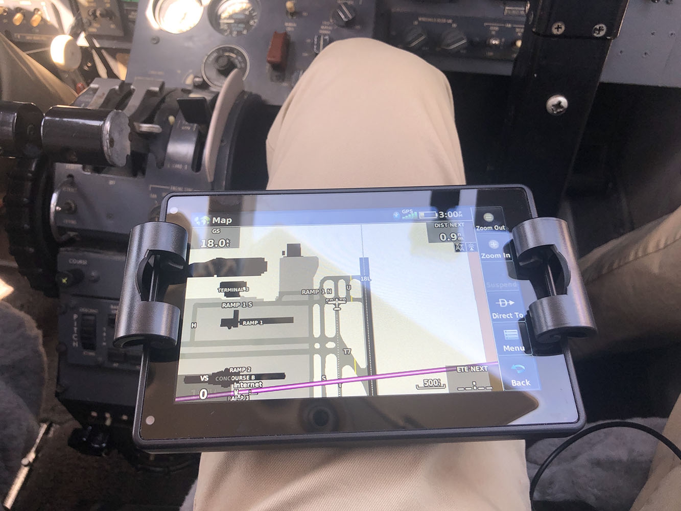 As impressive as this list of features is, some pilots might still ask, “why not just buy an iPad?” Certainly the latest generation of tablets are impressive devices and aviation apps like Garmin Pilot and ForeFlight are powerful in-flight tools. But there are a few features that make the aera 760 a solid choice for the demanding environment of a small airplane cockpit.
For one, the stunning 7” screen is truly sunlight-readable, with minimal glare and bright map colors optimized for aviation. Garmin says it’s twice as bright as most tablets, and we believe it. The screen works in portrait or landscape format, so it’s easy to fit on your lap, on a yoke mount, or even in the panel. The touchscreen interface is easy to use and will be familiar to anyone who flies with Garmin avionics.
The aera 760 is also completely self-contained, making it an ideal backup device. A four-hour battery and a dual GPS/GLONASS receiver are both built in, so there are no wires or external devices required (unless you want to view in-flight weather and traffic). In an emergency, it can guide you to the nearest airport and we would absolutely trust it to do so.
No, we aren’t throwing out our iPads just yet, but the aera 760 is a credible competitor for aviation use, and worth considering as a backup even if you fly with a tablet. We’ve also seen a lot of Garmin GPSs built into panels over the years, not as primary IFR navigators but as valuable situational awareness tools; this latest model would be a fine addition to an older panel.
 Mounting and details
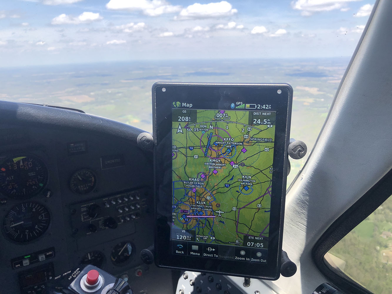
The aera 760 fits well on your leg, especially when the screen is set to portrait mode. We’ve used the MyClip Multi kneeboard system, and while it’s a tight fit it does work well. For mounting, the RAM 7” X-Grip is a great option. This grips the 760 tightly and is compatible with any other RAM Mount system - we like the yoke and suction cup options. While it’s not available yet, we would expect to see some panel dock solutions for this new model as well.
The aera 760 costs $1499 and shipping in late May; orders are being accepted now. Click here to order or for more information.
Watch our in-flight Product PIREP video here

